Early-season nor’easter prompts flood warnings for the Shore, and advisories for Philly into the weekend
The storm is unusually early, and it might foreshadow what's to come.
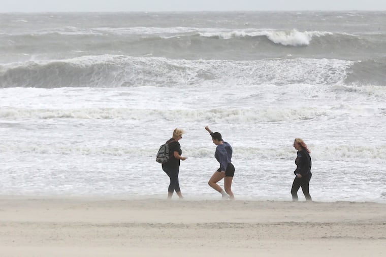
Flood warnings are up for the Jersey Shore, where winds could gust to 50 mph, and high-tide flooding is expected along the Delaware River into Saturday as that very early-season nor’easter matures off the Southeast coast.
On Thursday morning, the storm was gathering strength off the Southeast coast, as predicted, and the projected track was closer to the coast than earlier predicted.
But what’s been happening thus far at the Shore and Philly area likely has had more to do with an extraordinary system to the north that normally is associated with dry and tranquil weather, said John Gyakum, an atmospheric scientist and coastal-storm expert at McGill University in Montreal.
It is working in tandem with a burgeoning cyclone that he characterized as “unusual” for occurring so soon in autumn — actually, make that Day One.
Overall, he said, this has been a start to fall “that we haven’t experienced in quite a while.”
And while the El Niño intensifying in the equatorial Pacific likely has nothing to do with what will happen around here in the next few days, this nor’easter may foreshadow what is to come during the winter.
The National Weather Service on Wednesday was warning of potentially damaging “moderate flooding” with the “potential for widespread roadway flooding … as well as damage to vulnerable structures. Some roadways will become impassable.” In addition, winds could gust up to 45 mph at the beaches and 35 mph inland.
What’s more, the growing influence of the moon, which reaches fullness Saturday, is going to provide an astronomical tug to the tides.
The weather service also has issued an advisory for flooding along the Delaware River expected to reach moderate levels Friday and Saturday.
Officials in the beach towns were making preparations.
Ocean City was advising residents to “move vehicles to safe places,” spokesperson Doug Bergen said. And the Army Corps of Engineers moved its beach-fill equipment in Avalon and Ocean City to safe harbors.
The expected timing of the flooding
The weather service said moderate flooding could be expected on the oceanfront with four consecutive high-tide cycles at7 p.m. Friday and 8 a.m. Saturday, with minor flooding during the other hide tides.
Moderate flooding was forecast in the back bay areas Thursday evening and again on Friday evening and Saturday morning.
At the moderate level, some roads can become “impassable,” and some houses could incur damage, the weather service said.
Along the Delaware River, minor flooding was predicted for six consecutive high tides starting at 1 p.m. Thursday.
No rain is expected until the weekend, with the amounts very much dependent on whether the storm makes a westward jog toward the coast or stays farther out to sea. As of late Wednesday, the computer models still were disputing the issue.
For now, the weather service has a chance of rain both in the immediate Philly region and at the Shore.
It is likely to stay breezy through the weekend, but the winds are forecast to take a more northerly turn, rather than howling onshore. The switch would be gentler on the beaches, which will have lost considerable sand.
The nor’easter is getting a kick from the north
Temperatures in the region Wednesday were in the mid-60s, about 10 degrees below normal and close to what they would normally be in late October.
The chilly conditions were the result of a massive area of high pressure, or heavier air, over southeastern Canada.
Winds circulate clockwise around centers of high pressure, and thus the Shore and the Philly region have been getting brisk winds from the northeast.
The high is also supplying the cool air that is contrasting with the warm air off the Southeast coast, thus igniting the nor’easter, said Gyakum, who is credited with minting the term bomb cyclone.
Winds circulate counterclockwise around storm centers, so areas to the northwest of the center (see: Jersey Shore, Philadelphia) experience onshore winds from the northeast (thus the term nor’easter).
The two systems working in tandem are conspiring to generate gusts and potential rains likely to peak along the New England coast, said Bob Oravec, senior branch meteorologist at the federal Weather Prediction Center.
Still, the Jersey Shore impacts are likely to be significant.
What might the storm mean for the future?
Typically, El Niño does not start to affect weather in the Northeast until later in the fall and into the winter.
However, this storm could be a harbinger.
“There tends to be an increased number of nor’easters during El Niño events, particularly strong El Niños,” said Samantha Borisoff, climatologist with the Northeast Regional Climate Center at Cornell University.
Although this nor’easter is a precocious one, on the first full day of the astronomical fall, it is a clear indication the seasons have changed.
Said Oravec: “You can’t fool the sun. Eventually the atmosphere responds.”