A nor’easter is poised to rip sand from Shore beaches and flood roads
Along with winds and flooding, expect changes in the forecasts the next two days.
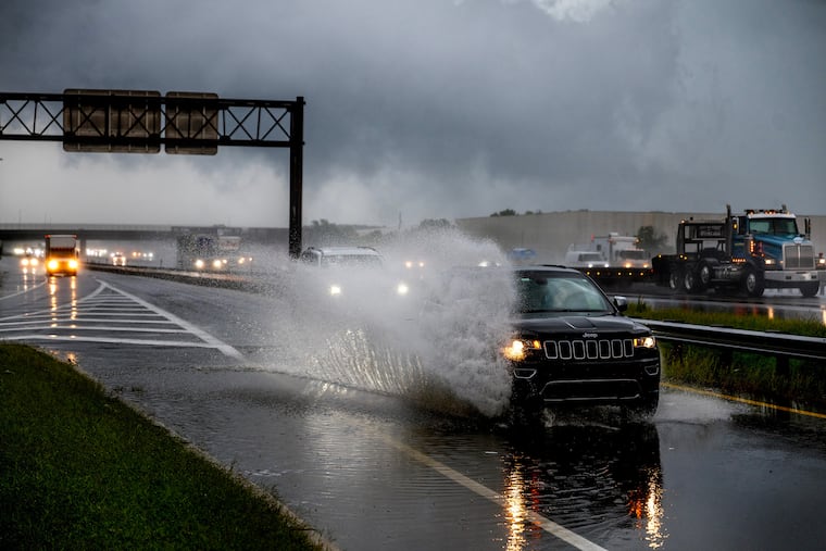
While computer models still remain at sea on the fate of a nor’easter taking shape off the Southeast coast, it is all but certain that floodwaters will be covering some roads at the Jersey Shore the next few days while the beaches lose some sand.
Already, the Army Corps of Engineers beach-fill contractor working in Avalon has decided to halt operations and move the equipment out of harm’s way, said Army Corps spokesperson Stephen Rochette.
The National Weather Service has issued flood warnings for the oceanfronts and back-bay areas in effect from late Wednesday afternoon until early Saturday, with moderate flooding expected in four of the next five high-tide cycles, warning that “many roads” may become impassable. The agency said it’s possible that some of the flooding could reach the “major” category.
Inland impacts remained a source of considerable less certainty, but the National Weather Service posted a flood advisory for the tidal Delaware River from northern Delaware to central Bucks County from 10 p.m. Wednesday until 4 a.m. Friday.
And after that?
“Once you get to Friday and beyond, the forecasts becomes uncertain,” said Zachary Cooper, a meteorologist at the weather service’s Mount Holly office.
As expected, a coastal storm was taking shape off the Carolina coasts and was forecast to mature through the workweek, generating winds from the northeast — that’s why they are called nor’easters — adding to an already brisk onshore flow.
In addition, with a full moon due Saturday, the tides are going to get an additional astronomical tug.
“There could be some shenanigans with that,” said Matt Benz, senior meteorologist with AccuWeather Inc.
The timing of the storm’s impacts at the Shore and in the Philly area
The winds were forecast to increase Wednesday, with gusts to 45 mph at the coast and 35 mph in the Philly area.
Moderate flooding was expected with the early-evening high tides on the oceanfront and back Wednesday, Thursday, and Friday evenings, and on Friday morning.
Minor flooding was expected Tuesday evening on the oceanfront and back bays at the Shore, with more-significant moderate flooding at high tides Wednesday and Thursday evenings.
Along the Delaware River in Philadelphia, high-tide flooding was likely to be minor but could approach moderate levels late Wednesday and Thursday nights.
No significant rains were in the forecast at least through Thursday, but the outcome for the weekend would depend on the intensity and path of the coastal storm, with rain more likely at the Shore than inland.
What’s with all the forecast uncertainty?
The food fight among computer models has persisted, with the European favoring a more westward track, and the U.S. model more out to sea.
A more westward track, which would make substantial rains, and more wind, more likely, Cooper said. For now, the weather service was going with a 20% to 50% chance of rain across the region Friday into Sunday.
The forecasts are far more certain on the winds.
The onshore winds Tuesday were the result of high pressure, or heavier air, over southeastern Canada. Winds circulate clockwise around centers of highs, and thus the winds from the northeast, which also explain the October-like chill, with temperatures getting no higher than the 60s this week.
An intense coastal storm would add mojo to those winds and could make for quite a raw weekend.
One thing that is a near certainty is that the forecasts will undergo significant changes in the next day or two.
Yes, this is early for a nor’easter
This is unusually early to be concerned about a nor’easter. They usually wait until later in the fall, when the temperature contrasts that ignite storms become sharper as warm air lingers and interacts with the ambitious colder air from the north.
However, a precocious nor’easter would not be as unusual as what is happening with the hurricane season in the Atlantic Basin.
That would be: nothing.
» READ MORE: The ultra-quiet Atlantic hurricane season is setting records, thanks to El Niño
The season already has set a record for the longest wait for a first hurricane, and nothing is cooking. It is also setting records for the least amount of tropical-cyclone energy, said Philip Klotzbach, hurricane expert with the Colorado State University Tropical Meteorology project.
But while it will not become a hurricane, Benz said the coastal storm bears watching because it could draw up moisture from the waters around the Bahamas and take on some tropical characteristics.
That would increase the rainmaking and wind potential, he said.
Stay tuned.