Storms bring rain and hail to the Philly region, and a tornado in Delaware
A tornado touched down in New Castle County, the weather service says.
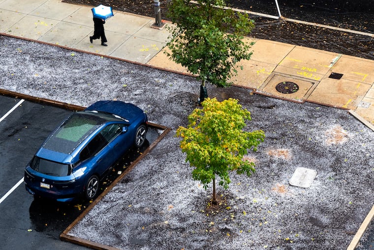
At least one, and possibly two tornadoes; downpours; widespread flash flooding; and torrents of hailstones — some reported to be as large as ping-pong balls — rocked parts of the region Thursday afternoon in advance of what will be the chilliest run of weather this season to date.
The National Weather Service Office in Mount Holly was investigating a possible tornado in Chesterfield, Burlington County, not far from the office, said meteorologist Mike Lee.
In addition, he said a survey team will be looking at a confirmed tornado site near Christiana Hospital, in New Castle County, Del., in which a helicopter was damaged.
However, for the immediate Philly area, the high drama was over.
Some showers were possible overnight Thursday into Friday, and more rain on Friday, Lee said, but no more of those white ice rocks from the sky, created by the rising air encountering cold air aloft.
By late afternoon, the hailstones had been replaced by outbreaks of rainbows. But flash-flood warnings remained in effect until early evening along the Delaware River from the Delaware border to Bucks County, where high water made Haines Street in Tullytown impassable.
Multiple water rescues were logged in Delaware County, where flooding caused issues on the Blue Route near Woodlyn, and on I-95 around Trainer.
In Philly, flooding disrupted traffic on the Schuylkill Expressway in the Grays Ferry area, and on Route 1 near Morrisville and I-95 at Bensalem in Bucks County .
In Jersey, floodwaters blocked a lane of Route 42 in the Williamstown area.
Overall, it was case of an anomalous storm preceding the region’s impending taste of December.
On average, according to weather service data, thunderstorms occur in November only once every two years.
The federal Storm Prediction Center in Norman, Okla., which had issued the tornado watch, said the mayhem was resulting from a complex storm system that was centered over northern Virginia Thursday morning and forecast to mature off the New Jersey coast.
It had been showing signs of being “a little bit stronger” than computer models had shown earlier, Lee said.
Come Friday, you may think you wandered into December. The storm was expected to draw in much colder air on winds from the northwest as it intensified.
Highs won’t get out of the 40s Friday, and stray snowflakes might even wander into the region, forecasters say. It will remain chilly through the weekend into early next week.
“It’s going to be a shock to the system,” said Tom Kines, senior meteorologist with AccuWeather Inc. “We’ve been spoiled for the last several weeks.”